Hyperspectral

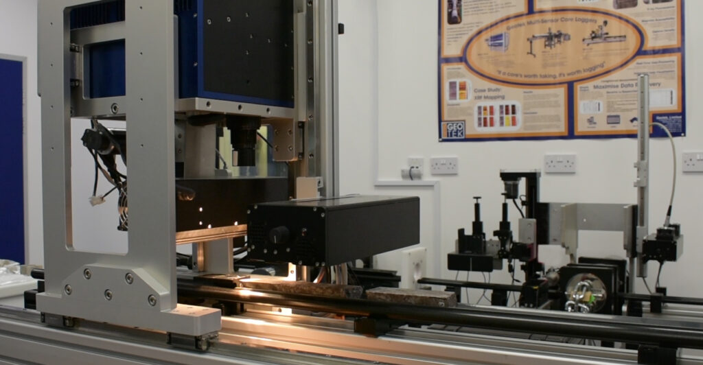
Hyperspectral Infrared Spectrometer

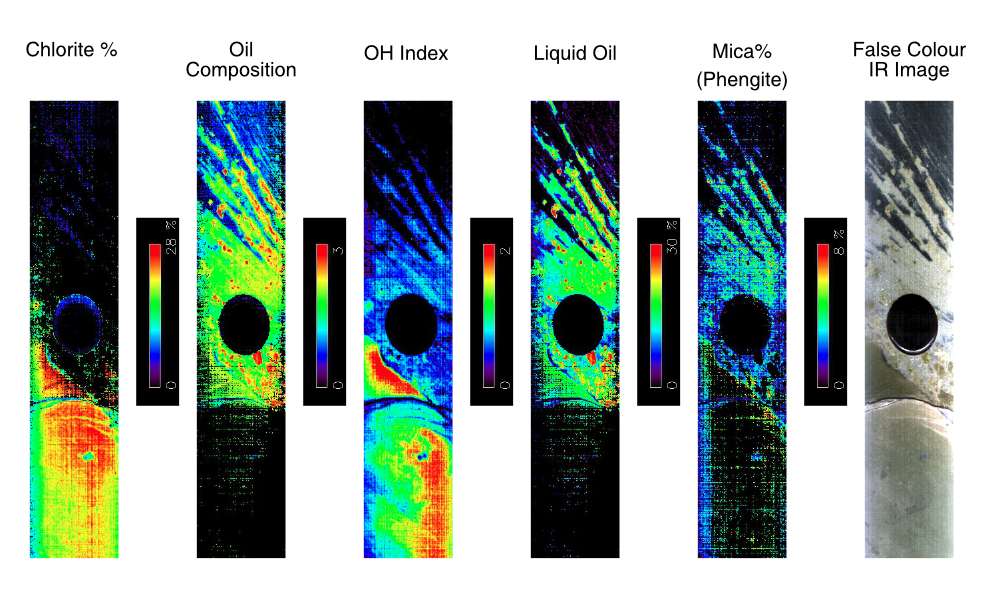
The SpecCam 4 hyperspectral camera uses real-time imaging infrared (IR) spectroscopy to identify and produce semi-quantified mineralogy from the surface of rock cores and cuttings. The acquisition of a continuous dataset allows for the production of mineral distribution maps to spatially understand the impact of clay, carbonate or alteration minerals for the geological assessment of oil and gas reservoirs or mineral exploration sites.

Hyperspectral IR spectrometry differs from other point sensor technology, such as the ASD Terraspec 4, by providing full spectral information across the core and down the full core length whereas the point measurement only provide information on discrete areas.

The SpecCam 4 hyperspectral camera is available on any of Geotek Multi-Sensor Core Logger (MSCL) platforms (MSCL-S, MSCL-XZ or MSCL-XYZ) and now uniquely offers the ability for users to acquire hyperspectral datasets alongside XRF, magnetic susceptibility, VIS and UV core imaging, and even density/porosity, P-wave velocity or spectral natural gamma all on one core logging platform.

Hyperspectral System

Method

Visible and Near Infra-Red (VNIR) and Short-wavelength Infrared (SWIR) reflectance spectroscopy measures the vibrational bonds of molecules and their overtones, seen as absorbtions in reflected light. Both crystalline and amorphous minerals (including hydrocarbons) can be measured. The exact positions and shape of absorbtions provide important information on precise composition, crystallinity and quantity of the mineral.

Fully supported interpretation software with customisable spectral libraries are offered with each system to process and interpret the spectra. These libraries are built from proprietary and public domain databases with specific minerals added to suite the application.

Mineralogical Mapping for Industry and Research

Hyperspectral VNIR/SWIR technology generates near continuous data over the entire surface of whole, split/slabbed core samples, plug and chips. Every pixel in a hyperspectral VNIR and SWIR image contains an infrared spectrum which is interrogated using specialist interpretation software to identify, quantify and map: specific mineral types, mineral chemistry, zones of mineral alteration, liquid and solid hydrocarbons, and contaminants. The subsequent mineral maps and mineral composition logs created from these data will enable geoscientists to more confidently determine the interrelationship between mineralogy and a rocktype’s physical and chemical characteristics, thereby improving the lithological description and stratigraphic correlation of geological formations.

Mineral Map

SpecCam 4 Technical Specifications:

  • Spectral range offered 400 nm to 2500 nm
  • State-of-the art optical dispersive filter with spectral supersampling tunes to specific wavelengths for better mineral discrimination and identification. Maximum spectral resolution in SWIR is 1 nm at 2200 nm.
  • Standard image resolution is 0.52 mm x 3 mm (although larger pixel sizes are possible for lower resolution studies)
  • Continuous coverage high image resolution has a pixel size of  0.5 mm x 0.5 mm
  • Speed ranges between 1 m and 4 m per hour depending on the spectral and image resolution selected
  • Bespoke spectral library and interpretation software, which includes spectra from proprietary and public domain spectral databases
  • Data exported as CSV line profiles and calibrated reflectance images in ENVI or Tiff formats

Applications of Hyperspectral VNIR and SWIR Core Analysis
Continuous mineralogy from SpecCam compared to standard downhole logging datasets

MINERALOGICAL IDENTIFICATION:

  • Quantify each clay type
  • Derive total clay
  • Identify Kaolin polytypes e.g. low-high crystallinity, halloysite, dickite
  • Determine Fe: Mg ratio of chlorites
  • Serpentine Group – Lizardite, Crysotile
  • Sulphase – alunite, jarosites, borates Chlorite-epidote group
  • Identify illite polytypes and distinguish 1M and 2M types to help identify authigenic/detrital origin
  • Identify illite/smectite ratios to provide information on temperature history
  • Discriminate smectite and identify Fe, Mg and Ca-rich types as well as high and low water content smectites
  • Identify mica types e.g. paragonite, muscovite, phengite
  • Identify abestiform minerals e.g. serpentines and amphiboles
  • Identify different carbonate species such as: calcite, dolomite etc