Laminography

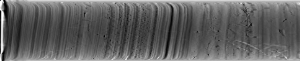
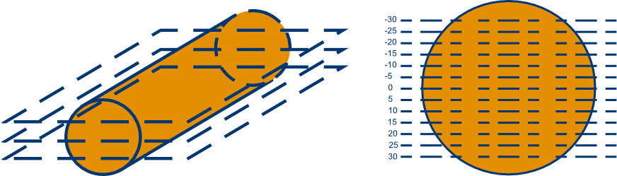
Acquisition Mode: Laminography

Geotek have developed a unique X-ray imaging technology, through tomographic reconstruction, which is used to extract 3D information from only 2D scanning of core samples.

Laminography is a faster, less expensive alternative to full 3D CT scanning, with a compact data footprint. It has been incorporated into all Geotek X-ray CT systems as a means to examine 3D geological features and internal structures within core samples without the need to split the liner.

How can you benefit from Laminography?

X-ray datasets, collected through laminography, may provide invaluable 3D data and insight into the internal nature of your core sample. Unlike radiography, laminography provides out of plane information, enabling visualisation and precise location of features such as gravels, IRDs, fractures, and vugs. In addition, by using laminography, 2D scanning can be transformed into unwrapped images to determine dip and orientation of beds. The unwrapped images are essential not just for orientation studies, but also for planning slabbing or splitting angles. Ultimately, laminography improves visualisation of geological features to aid understanding of core heterogeneity and quality.

Laminography for Geoscience

How does it work?

Laminography is achieved through reconstruction of 2D scans to extract sequences of ‘slabs’ at increasing depths cross-core. Features within each slab are brought into focus, enhancing sedimentary structures, and providing additional 3D information. Each slab is associated with a depth and therefore it’s possible to ascertain the position and size of dense nodules within the core.

How Laminography Works Diagram
Core slices of variable depths through a core sample (left image) used to create Laminographs. The central slice cutting through the core's diameter is labelled as 0, all above slices are labelled positive and all below are labelled negative (right image).

Laminography Imaging Workflow

Geotek X-ray System Workflow

Discover our dedicated workflow to maximise your data output and minimise operation time.

Data Acquisition Software

Geotek’s X-ray acquisition software was specifically developed for geoscience applications and has a friendly graphic user interface. The user may select the X-ray technique they wish to use for the scanning whilst setting up the scan at the start of a project.

Data Processing Software

Geotek provide a dedicated processing software package with all X-ray platforms. Once exported, radiographs can be viewed and processed using the ‘GQuickView software.’

Imaging processing filters can be applied to visually enhance core features and structures making them more distinct and easier to identify. The filters do not alter the raw image data (raw intensity values for each pixel), and can be easily removed if required.

The image processing features include:

  • Detail Enhancement
  • Virtual Compensator
  • Beam Hardening correction

  • Contrast adjustment (using intensity histogram)
  • Gaussian blur

Once the user is happy with the end result, they may save their processed image and export to JPEG format for further analysis.